
Tracing the Redding Street Directory by Address
A street question becomes workable when the search starts with the full situs address rather than a surname. In Redding, the county parcel and map systems supply an APN, the tax and GIS join key. That key can connect an address to ownership fields, owner mailing information, permits, and legal parcel context. The lawful voter channel is separate. It can confirm a person’s own registration through My Voter Status, or support a qualified voter-file request, but it is not a browsable street roll. Deeds establish recorded transfers, while reverse directories, census schedules, and newspapers add occupant history.
- Normalize the street address, including direction and suffix, then start at the Shasta Assessor Public Inquiry or GIS map. Record the APN, situs, subdivision, or legal context returned for the parcel.
- Open the parcel record by APN and compare situs with the owner mailing address. Treat the current owner as an ownership lead, not proof of occupancy or a list of household members.
- Use a lawful voter channel only for its intended purpose. My Voter Status is an authenticated self-lookup; a voter-file request requires a qualifying purpose and cannot become a street census.
- Search the Shasta County Recorder index by grantor or grantee, recording date, document type, document number, or book and page. Match the instrument to the APN or legal description.
- Walk the same street in GIS, clicking adjacent parcels and recording their APNs. This expands one address into a parcel-by-parcel street view without turning the map into a household roster.
- Switch to reverse or criss-cross directories, census schedules through 1950, permits, newspapers, obituaries, and probate for occupants and past households. Keep each date and record role separate.
Use the APN as the bridge, not as a person identifier.
Redding Records Along a Street
Each address-keyed source answers a different question. The Assessor connects a parcel to current tax evidence, GIS shows geometry, the Recorder shows recorded parties, and permit files show work tied to a location. Historical directories and census schedules are the stronger route to past occupants. Voter information follows a separate California privacy rule.
| Address-keyed record | Keeper | What it can show | Access and limit |
|---|---|---|---|
| Assessor inquiry | Shasta Assessor-Recorder | APN, situs, owner status, mailing address, values, exemptions | Free inquiry and counter service; no household roster |
| GIS parcel layer | Shasta County GIS | Parcel footprint, adjacent APNs, joined situs and map layers | Free map; APN is the join key |
| Recorded documents | Shasta Recorder | Grantor, grantee, instrument, date, legal parcel and return address | Party index and copies; street search is not reliable |
| Voter channel | California Secretary of State | One person’s registration status or a qualified file result | Authenticated or statutory access; no public street browse |
| Permit and code history | Redding and Shasta permit offices | Work, project, applicant, contractor, inspection or violation details | Portal or request; applicant may not be a resident |
| Reverse directory and census | Redding Library and archives | Historical occupants, neighbors, household and address clues | Library or archive access; local directory years are not verified |
APN ties the roll to GIS, deeds, permits, and parcel maps. GIS is free; the Assessor lists $12 parcel-history and $15 characteristics reports. Neither replaces the deed or a historical occupant source.
Shasta Assessor Fields for a Redding Street Directory
The Shasta Assessor Public Inquiry is reached through the Assessor-Recorder Kiosk. Its documented online controls do not begin with an open name search. The useful keys are fee parcel, assessment, boat CF number, and aircraft tail number. For a street lookup, obtain the APN from GIS or a county counter channel, then use the parcel key. California Government Code §6254.21 also limits posting owner-name information for protected people, so the public interface is not a frictionless people finder.
| Portal and field | Type | Required | Options or format notes |
|---|---|---|---|
| Assessor: Search By | Dropdown | Yes | FEE PARCEL; ASSESSMENT; BOAT CF#; AIRCRAFT TAIL# |
| Assessor: Search value | Text | Yes | For assessment, use the full 12-digit form or browse progressively from the leading groups |
| Assessor: Assessment Number | Linked result | Result | Opens assessment details; books 001-099 require leading zeroes |
| Assessor: Print | Button or menu | No | Quick Menu at the upper right |
| eTRAKiT: Search By | Dropdown | Yes | APN # or ADDRESS |
| eTRAKiT: Search Operator | Dropdown | Yes | Equals, At Least, At Most, Begins With, Contains |
| eTRAKiT: Search Value | Text | Yes | Enter the selected APN or address value |
A parcel result may include APN, situs, current owner/status, owner mailing address, values, exemptions, characteristics, and parcel history. Situs is the taxable location; mailing is where tax correspondence goes. A mismatch can reflect a trust, manager, mailing choice, absentee owner, or stale data. The homeowners’ exemption may support owner occupancy, but never identifies everyone at the address.
Redding GIS Controls for Street Browsing
The Shasta County parcel service uses polygon geometry and APN as its display and key field. The service metadata says situs and other attributes are joined by APN, which is the page’s useful local quirk: a map label and a parcel record are not the same data layer.
The Shasta County parcel-layer metadata documents the map source used for street browsing.
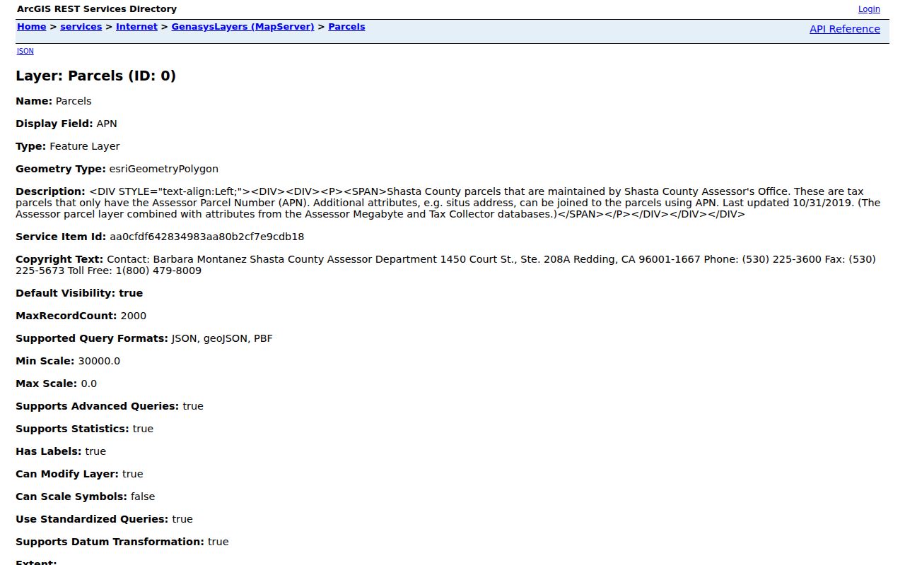
The parcel view is most useful when each selected polygon yields an APN that can be carried into the Assessor, eTRAKiT, and Recorder workflows.
| GIS control | Type | Street use |
|---|---|---|
| Address search | Geocoder text | Start at a subject address |
| APN search | Text | Open the exact tax parcel when known |
| Layer list | Checkboxes | Show parcels and available zoning, district, or hazard layers |
| Identify or select | Map click | Return parcel attributes and APN |
| Zoom and pan | Map controls | Browse both sides of a street segment |
| Measure | Map tool, if enabled | Approximate distance or area, not survey evidence |
Redding City Property Lookup adds a report layer. Address or APN leads to Generate Report, with coordinate, attribute, measure, draw, basemap, screening, and full-screen tools. Reports can return property address, APN, owner mailing city/ZIP, values, land use/unit count, subdivision, zoning, census tract, nearby services, flood/fire zones, police beat, and fire station. Public schema omits owner name but retains mailing fields.
Redding Street Directory Deed Trails
The Recorder’s Public Web Self Service begins after acceptance of a disclaimer. It calls the index a library card catalog and tells users to try spelling variations, initials, punctuation, reversed name order, and other criteria. The index guides to the document, not proof of current title, occupancy, or a complete street search.
The Shasta County Recorder index is the source-linked starting point for the grantor and grantee trail.
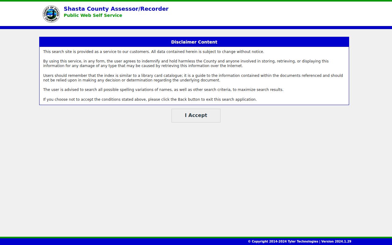
The screen represents a party-centered index. Match a result to the APN, legal description, recording date, and document image before treating it as evidence about a street.
- Grantor
- The party shown as transferring an interest.
- Grantee
- The party shown as receiving an interest.
- Parcel
- A mapped or legally described piece of land tied to an APN.
- Situs address
- The physical taxable location, distinct from a mailing address.
- Plat
- A recorded subdivision map that helps match lot, block, and parcel context.
- Criss-cross directory
- A historical directory arranged by street and house number, with occupants when the volume includes that section.
Search fields include Grantor/Grantee or Party Name, Document Number, Recording Date/date range, Document Type, Book/Page, and Search/Reset. The landing page does not state a definitive online cutoff. If the period is absent, take the latest book/page citation to Recorder staff, Digital Reel, or physical index/deed books at 1450 Court Street, (530) 225-5671.
Note: The Recorder landing page does not publish a definitive online start year, so older coverage must be confirmed with the office.
Redding Street Permits and eTRAKiT
County eTRAKiT adds a property and permit trail once the APN or address is known. Result tabs include Parcel Info, Owner Info, Restriction Details, Land Use, Building, Legal Desc, and Inspections. It also searches permits, projects, contractors, scheduled inspections, violations, and CRM issues. Its disclaimer says data may be out of date or inaccurate, so a permit shows work at an address, not an applicant’s residence.
The Shasta eTRAKiT parcel search shows the address and APN route used for this part of a Redding street directory.
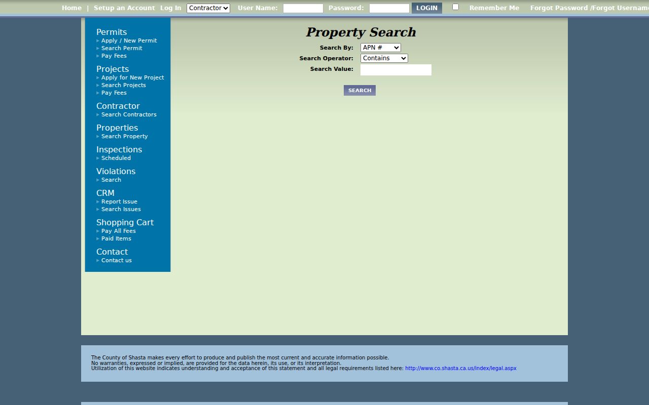
Permit history can date additions, fire rebuilding, changes of use, and contractor activity. Pair those dates with the Assessor and deed chain rather than treating a permit record as an occupant record.
Redding’s public-records page uses JustFOIA for submission, tracking, electronic delivery, and Permit History. A focused request should name the address, APN if known, record or permit type, and date range. CPRA does not require a purpose, but it works best with identifiable records instead of an open-ended resident list. Building permits moved to EnerGov Self Service in 2026; the live page did not expose a stable anonymous field inventory.
Redding Street Directory and Annexation Geography
A Redding mailing line is not the same as incorporated-city jurisdiction. USPS routes a city name, while Assessor situs, GIS boundaries, tax jurisdiction, and service districts decide how an address is recorded. A street-by-street search should therefore retain the parcel’s legal description and jurisdiction instead of inferring them from the postal city.
Redding’s 1872 townsite lay between North Street, now Eureka Way, and South, East, and West Streets. The city incorporated in 1887, covered 3.65 square miles at first, and reached 15.2 square miles by January 1, 1970. Much of Buckeye joined in 1969; Cascade Community Services District added about 3,000 acres south in June 1976; former Enterprise PUD added about 3,200 acres east in December 1976; and Texas Springs/Oregon Gulch later added 1,692 acres west.
Those changes explain why an Enterprise or Buckeye address can move between city and county record channels over time. No official dated citywide Redding renumbering or ZIP realignment was verified in the research. Use legal descriptions, subdivision maps, historical maps, and deeds to bridge an old address rather than inventing a renumbering date.
Note: A Redding postal address can cross incorporated limits, so GIS and parcel records must settle jurisdiction for each street segment.
Redding Street Directory Through Reverse Directories
Current parcel records show ownership relationships. Past occupants are more likely to appear in Redding Library’s genealogy area, newspaper microfilm, census schedules, and a reverse or criss-cross directory. The library has two genealogy computers, volunteers, bound works, periodicals, newspapers, and FamilySearch affiliate access. Its microfilm run spans 1852 to the present, while NewsBank adds searchable Record Searchlight text from March 10, 1991 to current.
The library’s public pages do not verify a Redding-specific reverse-directory publisher or year run. Check the catalog item by item and ask the reference desk at (530) 245-7252 before asserting that a volume exists. The obituary request form can supply a date clue when a directory entry disappears. Pair a street entry with the released 1940 or 1950 census, deeds, permits, and newspaper evidence.
Volume-by-volume historical holdings belong with the Redding historical city directory collections, while the address trail here stays focused on how a street record changes from parcel to occupant evidence.
Redding Street Directory and Lawful Voter Channels
My Voter Status is a self-lookup, not a public street directory. The California Secretary of State asks for first and last name, full date of birth, and a driver license or state ID number or the last four Social Security digits. A successful lookup returns the user’s registration status and location, party and language preference, polling place, upcoming election information, and ballot status. Newly registered online voters should allow at least 24 hours.
California Elections Code §2194 and Government Code §7924.000 protect home addresses, phone and email fields, precinct and identification numbers, prior registration, driver-license or ID data, Social Security digits, and signatures. The My Voter Status lookup cannot be used to browse a Redding street. A qualified voter-file request through the Secretary of State request program costs $100 for a statewide file or $30 per named voter, up to ten and capped at $100 per application. Voting history shows participation, not ballot choices.
Safe at Home and other protected records can stop an otherwise ordinary address trail. The voter channel is useful only when the purpose and access path are lawful, documented, and limited to the information California permits.
What the Redding Street Directory Cannot Show
The parcel layer is not a tenant or household roster. GIS can show a polygon and APN; the Assessor can show parcel and owner-mailing evidence; the Recorder can show recorded parties; and a permit can show an applicant or contractor. None of those fields proves who sleeps at an address, lists children or relatives, supplies utility customers, or identifies every person who receives mail there. Owner mailing and situs are different functions, and neither should be silently converted into occupancy.
Lawful personal use. Redding address and property records may support genealogy, house history, family reconnection, and civic research. Do not use them to stalk, harass, intimidate, or expose a protected address.
Keep each result dated and label its role: owner, mailing recipient, recorded party, applicant, or historical occupant. If the goal shifts from a whole street to one person, the Redding resident lookup route can combine name variants, court, vital, business, and professional records without turning the street directory into a person-hunting list.